Saturday, December 4, 2010

Paradise Snow Shoe Mount Rainier Take 2


With a clear day in the forecast four of us decided to set out for Mount Rainier for a day of snowshoeing. We drove up to Paradise with plans of exploring Manzama Ridge. We checked in with the ranger who was less helpful than most rangers I've encountered. We did learn that the trail had not yet been poled but should be navigable. It was a clear morning, but some ominous clouds sat in the distance. Now this was the second time I've attempted to snowshoe Manzama Ridge. I had planned to go last January, but low visibility sent us to Reflection Lake instead.

We started out our adventure heading north from the parking area. It was beautiful as we headed toward the mountain, but after about 15 minutes the clouds started to roll in. The wind picked up blasting us with icy snow in the open areas. We stopped for a quick lunch in a clump of trees and forded onward. When we made it to a clearing we started to become a little unsure where we should go. The clouds had rolled in a bit more and it was snowing lightly on us. We saw a few people heading northeast up what seamed way to steep to be our route and decided to head in a more easterly direction. Looking back at the map we should have continued upward if we wanted to get on skyline ridge and head over to Manzama. We decided to abandon our hopes of the ridge since we had lost our chance at getting a view and head back down an adventurous route down to the road. It's amazing how the openness of the Paradise area combined with snow can really skew your judgement on distance. It felt like we had hiked quite a ways, but had we been there in the summer it would have seemed like nothing. All in all it was still a beautiful day in the mountains.


Friday, September 3, 2010

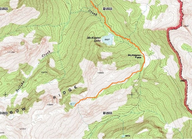
Rainbow Ridge Backpacking


McAlestar Lake


McAlestar Pass
On Rainbow Ridge off the trail
Unnamed lake where we camped

The view south from the lake


Bear print!

Friday, May 28, 2010

Ruckle Creek - Benson Plateau - Eagle Creek Loop

For the first ever SSDL group backpacking trip we decided to head south to Oregon in search of less snow and hikes that would still be fun despite the rainy forecast. We decided upon the popular Eagle Creek hike, but decided to make it a loop by adding on Ruckle Creek, the Benson Plateau, and about 4,000 ft in elevation. Our journey started at the Cascade Salmon Hatchery along the Columbia River. From there we began our ascent up the Ruckle Creek Trail. Being Memorial Day this was our first backpacking trip of the season and we were all a little sluggish, but managed to make the approximately 6 mile hike in without too much trouble. We were surprised to find quite a bit of snow in the area, but luckily the Benson campsite was mostly melted out.


Looking down at the Columbia


Shooting Stars along the trail


Our slightly snowy camp

The next day it was time for a little more climbing to the top end of the Plateau and then the steep drop down to Eagle Creek. So far we had the trail to ourselves, but that soon ended once we reached the falls.


One more view of the Columbia


About to begin the descent down


Steep descent to the falls


A grove of oaks along the trail

Once down at Eagle Creek we headed toward the trailhead a bit and set up camp at Wy'East camp site. After that we decided to go explore the falls furthest from the trailhead and headed toward Tunnel Falls. We went to the falls just past Tunnel before we decided to head back and call it a night. This is definitely not terrain for those with a fear of heights.


Tunnel Falls

Day 3 we awoke to drizzly rain which really just added to the lushness of the area. We packed up camp and headed back the last 5 miles to the car enjoying the many falls along the way.


The steep trail


Twister Falls


The narrow canyons


Loowit Falls


Punch Bowl Falls


Standing down in the bowl

Our Route

Wednesday, March 10, 2010

Mount Si


So I can't call myself a true Seattlite until I've done a trip to Mt. Si--perhaps the most popular hike in Pugetropolis. So with the sunny weather this weekend, Sarah and I decided to make the hike. We were far from alone, but it was a nice hike none-the-less. Eight miles round trip and 3100 ft in elevation gain, it's a good get back into shape for summer kind of hike. We passed on reaching the true summit on top of the haystack. The lingering snow had made the rock slippery and it isn't a place you'd want to misstep on. However, we were intrigued by the couple and their dog who made the climb. All in all a great day.


The view to the east


The shoot we climbed up

The final haystack


Sarah near the summit

Sunday, March 7, 2010

Greider Lake

After too many rainy winter days spent inside we needed a trip to the mountains. After some research we found a hike that supposedly would be snow free long before many other destinations in the Cascades. So we decided to give it a try.

Greider Lake is a 7.1 mile roundtrip hike that ends at two lakes and passes a small pond at the start. It climbs 1370 ft and is a fairly easy hike. The lake is part of Sultan Basin which is Everett's public water supply so you will need to sign in and acknowledge the rules and regulations for recreation use.

Sure enough, the trail was snow free and relatively dry. The climb up is a little monotonous with lots of switch backs, but once you reach the high point it opens up a little and offers a nice change of scenery. When we got to the lake the temperature dropped significantly so we didn't spend too much time hanging out. The trail was a little overgrown and we got pretty wet trudging through the overhanging vegetation. We passed one group headed down after what they said was a cold and wet backpacking trip. Other than that the trail was pretty quiet. We did see a sign at the trail head warning of recent bear activity, but we saw no signs.

Big Greider Lake


To reach the trail head take Highway 2 East toward Sultan. At the light east of town (past mile marker 23) turn left (north) onto Sultan Basin Road. Follow it for 13.25 miles (the pavement ends at 10.25) to the information kiosk where you sign in. Then continue 500 feet farther to a Y intersection, bearing right onto Forest Road 61. From there the trailhead is another 7.1 miles. We had a little difficulty finding it at first because there are numerous junctions during the last 7 miles. A forest service map is helpful to make sure you're remaining on the correct road.


Wednesday, January 20, 2010

Pyramid Lake


This winter, my graduate school did an exchange with the North Cascades Institute. We were treated with the pleasure of staying on Diablo lake for the weekend and doing a little exploring of the area. A group of us decided to make the short (4.5 mile) hike to Pyramid Lake. It was a nice leg stretcher following up a babbling creek through some nice sections of forest. The lake itself was rather small and totally frozen, but offered some nice views of pyramid mountain in the background. This is not a hike I would drive out of my way for, but it was a nice walk, especially for the winter.


Pyramid Mountain

The frozen lake


Looking down on the lake


Some of the group