Showing posts with label Day Hike. Show all posts

Sunday, June 8, 2014

Camp Muir - June 8, 2014

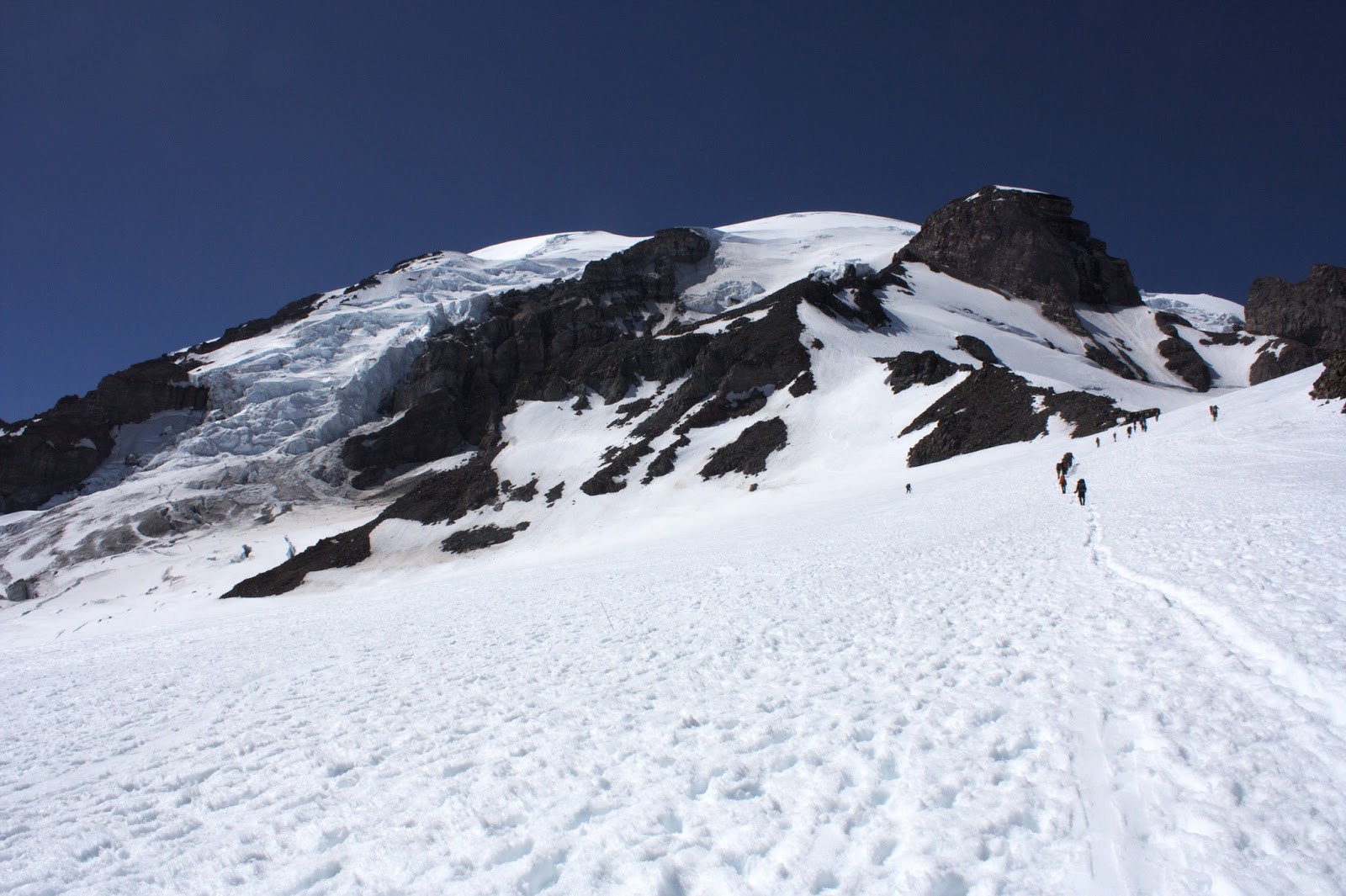
Sarah and I were looking to do a conditioner to prep for our upcoming trips to Mt. Baker. Camp Muir with almost 5,000 ft of elevation, mostly on snow, definitely fit the bill. This was my first time up to Muir and there were a few things that surprised me. First, you can see your destination for a good majority of the climb and although it looks pretty close, it still took quite a while to get to. Second, my body does not like transitioning to altitudes above 9,500 ft. I was feeling great then all of a sudden it started to hit me and it was like I was hiking in jello--everything just felt sluggish. Lastly, people do some terrifying things with their ice axes. I saw every crazy thing you could imagine including people holding their pick facing toward their stomachs, people glissading with their ice axes about to stab their thigh the moment they hit a bump and small children running and flailing with axes. I was certain I was going to have to use my WFA skills at any moment. Luckily we and everyone else on the mountain made it home in one piece.

Big R

Snowy Marmot

A rope team heading up

we had lots of company

Long line of folks climbing

Clouds rolling in

A little busty uppy


High above the clouds

Just a few people camped out


Gibraltar Rock

Cathedral Gap on the DC route

More tents

Scenic outhouses at 10,000 ft

Looking towards Mt Adams


Muir snowfield

Me and the Tatoosh range

Sarah

Snow over ice

Clouds taking over the summit


Saturday, April 5, 2014

Teneriffe Falls - 4/5/14

For my birthday weekend, I wanted to get out and do a little hike. Unfortunately the weather wasn't looking too great so Derrick and I decided to head to Teneriffe Falls. The trail stays mostly in the trees so the rain wasn't too bad. The falls were nice, but nothing too impressive.


Stats:
1,420 ft elevation
6 miles

Saturday, February 8, 2014

Stegasaurus Butte - 2/8/14

Sarah and I were feeling the need for a winter leg stretcher and decided to check out Stegosaurus Butte near the Pratt River trailhead. This was a pretty straight forward ridge climb up to a high point. There was some snow, but we didn't need our axes. Tucker came along for one of his first off trail adventures. 


Garfield 


Stats:
1,100 feet of elevation
1.4 miles round trip

Sunday, August 25, 2013

Mirror Lake and Tinkham Peak - August 25, 2013

Looking for a more low key day, Derrick and I met up with Greta and Matt and headed to Mirror Lake near Lost Lake on I90. At Lost Lake, we were met with the after math of what looked like a giant party at the lake the night before with bottles everywhere and people passed out in cars. From there we hit the trail and made the easy hike into Mirror Lake with a quick stop at the less-interesting Cottonwood Lake.


From the lake, it was a pretty straight forward class 2 scramble up the ridge and to the summit. We followed a noticeable boot path for much of the route. Once on top we were treated to lovely view made extra dramatic by the smoke out on the eastside of the mountains. It was a great quick outing that allowed us to be back in the city by mid-afternoon.

Heading up the ridge

Derrick lounging on the summit


Haze to the east

Lost Lake and part of Keechelus


I90 summits

Silver Peak

Tinkham Potholes

Looking southeast

Stuart stands alone

Mt Rainier

Heading back down

Greta on the descent

Matt and the boulder field

Derrick and Mirror Lake


Sunday, August 11, 2013

Mt Washington - August 11, 2103

A group of seven of us from the Bushwhackers head up to Mt Washington in the Eastern Olympics as part of Patrick and Celese's annual climb and BBQ. Mt Washington at 5944ft, is the second large peak on the left that you see when you look out at the Olympics from Seattle. It sees significantly less people than its neighbor to the south, Eleanor. This is a pretty short but steep scramble that starts from an unmarked pull off along the road and heads up a climbers trail. There are numerous routes to the summit, but we opted for the easiest and probably most common, nothing more than a few brief class 3 sections. Patrick had done this hike about 8 times and had the route down.

The hike up was a lot more interesting than some scrambles, with a lot of variation in the terrain. There were several distinct sections (all of which Patrick had named) that felt almost like you were progressing through levels on a video game.

We met up early in Hoodsport and were in good spirits despite some ominous and foggy weather.  Luckily, by time we were at the trail head, things were looking up a bit. At least we could actually see the mountain! The first section of the hike is probably the steepest. It follows a boot path through huckleberry bushes (which were ripe!) and ends at the "Meandering Meadow."

Mt Washington from the trailhead
 After the meadows comes another section of boot path under forest cover (mostly cedar) with a few blow downs obstructing the way. This ends in at the "Primal Scree" which is a little bit of a two steps forward one step back kind of place. Soon after this you reach a pivotal moment, either enter the "Holy Gully" or take the "Round About Ridge." In the words of Doug, "gullies are for the gullible." You definitely want the ridge. Cross the little creek before it heads into the gully and climb up about 20 ft to the ridge. The ridge leads up towards a big knob and then begins the "Upper Meadows."

The knob at the start of the upper meadows

Marine layer over the Puget  Sound

The Upper Meadow, (the Secret Ramp is just left of the snow field)
 After a nice walk through the meadow, things get a bit more scrambley. There's a section of walking next to a cliff wall and then a second scree field and the oh so important "Secret Ramp" that leads up to the saddle. From the saddle you follow the boot path up and climbers right. There's one short section that is a little exposed, but really it looks worse than it is. Then its a little scramble up and around to the summit. Unfortunately, most of our summit view were obstructed by clouds, but we still had a great time. It was a little over three hours to the top and less time back down.

Our view from the pass

Fortified tent site on the saddle

Final summit block

One exposed section, not as bad as it looks
Group summit shot

Climbers in route

 
Brief summit view

More clouds rolling in

Looking down towards where we started

These kinds of moves not necessary

Heading down towards the Upper Meadow

It's a little bit slippery here

Patrick heading down

Our track


Thanks to all for a great trip!