Showing posts with label Cascades. Show all posts

Thursday, June 26, 2014

Mt. Baker - June 26-28

The final climb of the Bushwackers Glacier Course is always an attempt of Mt. Baker with a day of crevasse rescue on the Squak Glacier. Team One had a successful summit and great stories to share, but as Team Two prepared to set out, the forecast was looking a little grim. Despite 50% chance of showers, we were in good spirits as we met up bright and early at the Seddro-Wooley ranger station. We picked up our permits and headed to the Schrieber Meadows trailhead. We started on the trail for a brief section, but soon cut up the Metcalf Moraine navigating a few tricky stream crossings.

Lana picking her way across the creek

Said taking a turn

We made our way, slow but steady, onto the snow. We had brief views of the summit, but ominous clouds were rolling in. In route we saw a strange mammal on the snow--definitely not a marmot. Our best guess: Wolverine. We took a brief break at some flowing water to refill our water bottles, then slogged on the final push to Cragview Rock to set up camp.

One of our fleeting summit views

Heading up the snowfield

Nearly to camp

Goodbye views

At camp, we watched a WAC group practice their crevasse rescue skills on the same crack where we were planning to use the next day. It had started to mist and we were thankful to be down at camp and not up on the glacier. Little did we know what the next day had in store for us. Knowing the weather wasn't looking great, we decided to play it by ear in the morning. We had the entire next day reserved for crevasse rescue practice.

It rain most of the night and we woke to thick clouds and more rain. We waited around a bit, but when it showed no sign of clearing we geared up, roped up and headed to the crevasse. It was eerie knowing we were right next to a big crack but not being able to see it until we were near the edge. We wanded out the area, set up extra protection and took turns lowering each other into the crevasse. For those who don't know, crevasse rescue isn't a super speedy process, especially when you're first learning. Cycling through eight people took quite some time. It also involves a lot of standing around and lying in the snow. After several hours of being rained on, we were all pretty dang cold. In fact, the warmest spot on the glacier was inside the crevasse. I was the last one to finally get lowered down. It was a little unnerving taking the first step into the abyss, but it was pretty amazing to hang out down there. 

I'm in a crevasse!

Wall of ice


Such a cool place

It was a wide crack

Just hanging out

The only thing connecting me to my team

Towards the end of the our practice the rain briefly stopped and the wind began howling. It was still super cold, but thanks to the wind we were almost dry. But that only lasted a minute. We thought we were going to make it back to camp dry, but with about 10 minutes left on our hike, it began to pour. Thank goodness we brought a kitchen tent to hang out in that afternoon/evening. Otherwise, I think we may have all gone a little stir crazy in our tents. 

Making dinner

Soaked but in good spirits

By this time, we had all pretty much given up on a summit bid the next morning. Although, there was about 15 minutes where the clouds parted at 1:00 am, but it was short lived. We spent the next morning eating as much of our extra days worth of food as possible and waiting for a brief break in the rain. Luckily, we got our moment. For almost an hour, it didn't rain and we were able to pack up our camp in peace. The sun even shown ever so slightly. The mood at camp skyrocketed and we were loving being able to be out of our tents and not get wet. On the way back down our rain came back. We were all pretty ready to be warm and dry and drinking a beer and hustled to the cars as best we could. The trip definitely had its rough moments, but it was a great group of folks that knew how to make the best out of a difficult situation and I'm really thankful for that. 

Our glorious break in the rain


Our kitchen

Glacier above camp near where we practiced

We almost had a view

Looking down from camp

Headed down the mountain

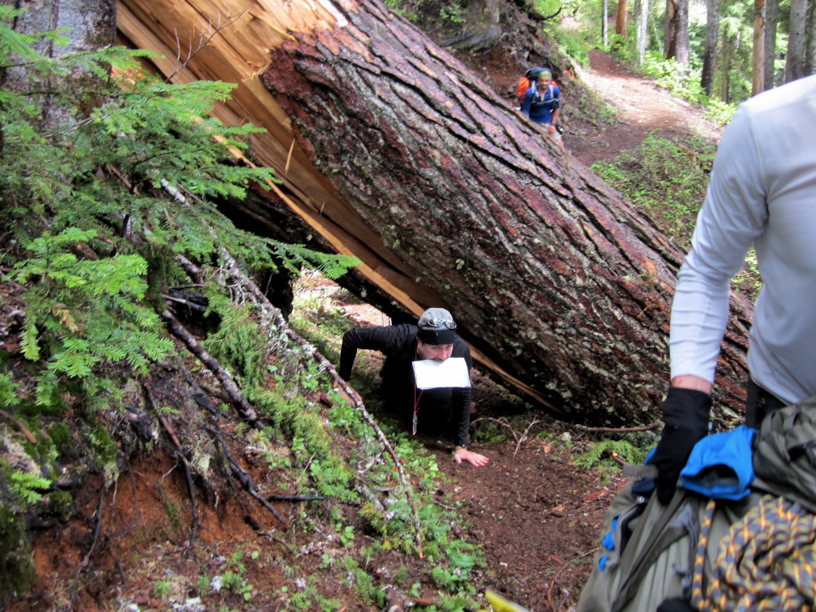
One final obstacle

Jake squeezing through


Saturday, May 31, 2014

Silver Peak - May 31-June 1, 2014

This overnight outing was part of the Bushwhackers Glacier Course. But before I go into the details of our trip a little back story. I was all set and ready to leave super early Saturday morning. Friday night Derrick and I went out with some friends to celebrate a birthday. Everything seemed normal and we headed to bed at a decent hour. Some where around 4 am Derrick wakes me up and says his stomach hurts. I go through the usual; did you take some medicine, what are your symptoms, why don't you just rest and try to sleep, etc. I fall back asleep and think nothing of it. About an hour later, Derrick wakes me up again and says it really hurts. He decides to call a 24 hr nurse line. The woman on the phone told him it could possibly be his gal bladder or something else major and he should go to the ER immediately. Although, I didn't know that's what she said at the time. We have a conversation about options and Derrick insists that its probably nothing and I shouldn't miss my trip. He decides to call his sister who arrives soon after I leave and takes him to the ER.

Well, long story short, my hike was in cell range almost the entire time so I start receiving text messages informing me about everything happening at the ER. They rushed him in for a bunch of test, decided it was an appendicitis and prepped him for immediate surgery. Sure enough the surgery was over before we even reached our camp site. It was a crazy turn of events that escalated way quicker than anyone expected. Needless to say, had I known he was going to have surgery, I would have definitely bailed on the trip. I love the mountains, but I love Derrick more.

With that said, it was a pretty awesome trip. Obviously the first part was a little weird, but once I knew all was well and our friends were looking after him at home post surgery, I was able to relax a little and enjoy a pretty sweet area. 

We set up camp just below the large bowl below Silvers summit. We were in camp pretty early and spent time practicing our rope skills. It was a huge confidence booster to do team self arrests over and over and over and to be able to stop real falls. That evening, myself and some of team one headed up for a fun little scramble along the ridge to the summit for a lovely sunset and views over the cascades. The next day we walked through initial response and practiced setting anchors and belaying. All while enjoying a beautiful day of full sun above the clouds. 

Looking down at Team One's campsite

Nice bowl below the summit

Team One getting ready to go


Team self arrest
More practice
Snoqualmie Peak
Silver Peak
Some folks hanging out on the ridge above the bowl
The bowl and our camps
Mt. Rainier
Annette Lake down below
Summit sunset
More sunset
Sunset over our camp
Sunset glow on the peaks north of I90
Sunny camp Sunday morning
Our camp above the clouds

Peaks of the Alpine Lakes Wilderness

Sunday, May 25, 2014

Wrong Turn, Three Brother Teanaway Loop - May 24-26, 2014

Sam, Sarah, Derrick and I decided to kick off the backpacking season with a weekend in the Teanaways. After Sarah and my last great adventure in the Teanaway, we were pretty excited for some peak bagging and ridge camping. This time we set our site on the Stafford Creek basin. We drove up Friday night to car camp and get an early start on the trip.

Lower Stafford Creek Basin
After several miles on the trail we eventually began to reach the upper basin and break through the tress and on to the snow. At Navaho Pass, Sarah and I ditched the guys and head up to Wrong Turn peak, a quick climb ridge climb up the saddle to the left. The views were splendid although not quite as stunning as some of the neighboring peaks.
Snow covered Earl

Stuart

Panorama from Wrong Turn

Navaho from Wrong Turn
Back at the saddle we regrouped and set our sites on Navaho's south eastern ridge. We originally thought we could take the trail to the saddle, but struggled to find the trail even with relatively low snow. So instead we began a long, steep, scree-filled traverse. After getting completely sick of traversing, we found a less steep slope and headed up the scree to gain the ridge. It was a rather unpleasant climb that put us at our destination a bit later than we had intended. We quickly made a pizza dinner and set up camp. Unfortunately, Sam was suffering from some stomach issues and Derrick was at his limit of off trail route finding adventures. But Sarah and I were in high spirits and enjoyed a lovely sunset over a special landscape.

Sun setting on Earl

Rainier
The next morning Sarah and I set out for Three Brothers. The weather was starting to take a turn but we decided to go for it anyways. We found a section of the ridge without cornices and dropped down into the bowl on Navaho's southeast face. From there we fairly easily connected with the Three Brother's saddle and proceeded up the ridge. By time we made it to the top the wind, rain and snow had picked up and the views were lacking. We made quick time back to the bowl and then up the snowy slope back to camp.
Busted up cornices east of Navaho

Snowy side of Navaho's ridge

Miller

Three Brothers
At camp, we met up with the guys and began descending the ridge towards the saddle between Navaho and Freedom. Once in the saddle we debated whether or not we were going to go for Freedom. The guys were not motivated to climb anything in the deteriorating weather and Sarah and I decided we were content with our two summits. We then began to descend from the saddle back down to the Stafford Creek trail. The descent was fairly straight forward. We stayed on a slight ridge to the left of a gully. Once on the trail we made good time back to the car.
Clouds over Earl

Clouds blasting Freedom

Three Brothers

Navaho and Three Brothers


Derrick at our ridge campsite

One more look at Earl


Stats:
2 days
5,984 ft of elevation
14.2 miles