 |
| Our route |
Headed out to the Teanaways for the first time. Sarah and I decided to throw together a some what off trail ridge and summit adventure. We drove up on Thursday after work and camped near the Beverly Trail head. On Friday we hit the trail at a little before 9 and headed up to the Bean Creek Basin. This being my first real backpacking trip of the summer, I was definitely feeling a bit on the slow side, but we made it up without too much trouble. From the basin the trail turns into a boot path that we partially followed up to the saddle. At the saddle we dropped our packs, put on our helmets and headed towards Bean's summit.
 |
| Panorama from the Bean Creek Basin |
 |
| The top of Bean |
The climb up Bean is fairly easy thanks to the nice sticky red rock. We had fund scrambling the many boulders and made it up without any problems. The view from the summit is stunning with the Enchantments right in your face. We couldn't find a summit registry, but did have the peak to ourselves. After some lounging and many photos we headed back to our packs to continue the slog up the ridge to Earl.
 |
| The Enchantments from Bean |
At this point we were feeling envious of day hikers, as our full packs made navigating the scree and rocks a little challenging. At one point, we dropped below the ridge on the south side to try and avoid some big boulders and ended up dropping a bit too low into some slick scree. After that section, we were able to connect with a boot trail that took us the rest of the way without much problem.
The summit of Earl was even more stunning than Bean. You see not only the Enchantments, but numerous peaks to the west in the Alpine Lake Wilderness. We did find a registry on Earl and signed it.
 |
| Panorama from the Summit of Earl |
 |
| Staurt as seen from Earl |
 |
| Me on Earl |
 |
| Cornices along the county line |
After a long rest on the summit, we decided we needed to drop down for the night to some where with water. We decided to head down the east side of Earl towards the small tarn that is visible on USGS maps. The tarn was still mostly frozen, but there was a nice creek leaving the snow field. We also found a good flat,dry spot to set up our tent. The scramble down from Earl was not too bad, some scree and some snow.
 |
| Looking towards Navaho from Earl. We camped on the bare ground visible in the basin |
 |
| Our camp the first night |
The next morning we were up early. Our tent, even without a rain fly, was feeling pretty hot by about 6:30. The sun was really blazing. From our campsite, we could see the trail at Navaho Pass and decided to traverse over from our campsite to meet up with the trail. It took us about 2 hours to pick our way through snow and rock and end up at the pass. From the pass, there was an easy to follow, yet very steep trail, up to the summit of Navaho. We were happy that this time we only had on day packs. We made it up to Navaho a little before noon and although we saw a group coming down, we had the summit to ourselves. Again, another beautiful view. On the way down we saw about 6 people coming up and a few other groups on the trail below the pass. It looked like it was going to be a busy Saturday on Navaho.
 |
| Looking back towards Rainier, Earl, and our tent |
 |
| Relaxing on Navaho |
We headed back to our camp for some afternoon lounging. We had noticed a campsite up on the ridge just below Earl's summit and decided to make that our destination for the night. We waited until it cooled off just a little and headed back up Earl with our packs. We found the ridge again completely empty and set up our tent. This currently stands as one of my favorite campsites I've stayed at. We had amazing views and complete solitude and it was such a warm night that we could easily sleep with out a rain fly.
 |
| One of my all time favorite campsites |
 |
| A little spec on top of the world (look closely and you'll see our tent) |
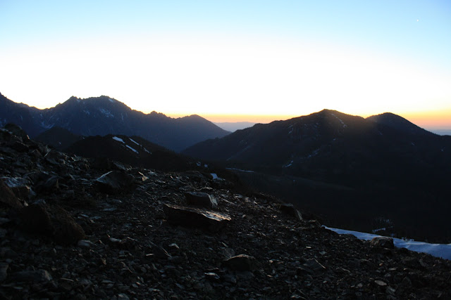
That evening we scrambled back to the summit to watch the sunset, which was beautiful and we felt overjoyed to be up in the mountains. It was one of those nights that felt like it never really got dark because the moon was so bright and the sky so clear, but we managed to get some sleep. We woke up on Sunday morning at 4:15 to watch the sunrise and the alpine glow fill the sky. Another awesome experience. We headed back to the car via a boot path that goes down the southwest side of Earl and connects with the main trail in the saddle below Earl which took us less than 2 hours. All in all, it was a stellar weekend and a we both came back on a mountain high.
 |
Sunset
|
 |
| Sarah on Earl |
 |
| Sunset and Navaho |
 |
| Panorama Sunset |
 |
| Green lichen on Earl |
 |
| Sunset over Stewart |
 |
| Sunrise |
 |
| Sunrise from tent |


