Saturday, July 13, 2013

Marmot Pass - Charlia - Buckhorn July 13-15, 2013

This past weekend I had a work event on Saturday morning in Grayland and again on Monday night in Port Angeles, and guess what lies between these two towns...the Olympic Mountains! Not wanting to lose an entire beautiful July weekend to work, I dragged along Derrick to my work events and we managed to squeeze in two nights of backpacking. Destination-- Marmot Pass and beyond.

Marmot Pass is on the eastside of the Olympics in the Buckhorn Wilderness about 5 miles up the Big Quilicene River Valley and receives lots of praise in guide books and trip reports and for us, this trip did not disappoint. Because I had to work for the first half of the day and because Grayland isn't exactly close to this hike, we didn't make it to the trail head until almost 7:00pm. We decided to just hike in as far as we could and set up camp for the night. We were hoping to at least get to Shelter Rock campground or beyond, but after about an hour of hiking we were informed that a large group of kids had taken over that spot so we decided to just call it an early night at a little spot near the creek just before Shelter Rock.

Camp the first night

 At some time in the wee hours of the night I woke up to Derrick informing me that there was an animal outside our tent and it was digging. I thought he was crazy and should go back to sleep, but sure enough there was a pretty good size pile of dirt on the rain fly. He thought it was a badger, but I had a hard time believing it. After a few minutes the culprit revealed himself—a tiny little mouse. Again, I tried to go back to sleep, but Derrick was not happy with the little rodent. His solution; turning his headlamp on and shining it where the mouse had been digging, all night long! Well, it did work.

The next morning, we were up and on the trail by about 8:00 and up at the pass around 10:00am. Since it was a Sunday, we saw lots of folks coming down from the pass and went in search of a place to set up for the night. From the pass we continued up the south ridge over to the second high point where we found a nice spot to camp. The views were great and there was a patch of melting snow that had enough of a trickle to pump water from. After a little lounging we decided to head down the southern ridge towards Charlia Lake and explore. 

The view looking south from our campsite

Looking down the Big Quilicene 

One of the high points along the ridge

Looking to the west

Looking down at Boulder Shelter 

If you look real closely you'll see our tent (and Grey Wolf Mtn)

The summits of Buckhorn

Derrick going up

A scenic little tarn along the way

There's a bit of a goat trail/boot path along the ridge. It took us on a bit of a scramble up to a high point at about 6520, then flattened out a little and headed down and around to the south side of Lower Charlia Lake's north ridge. Here we took in some nice views of the lake and enjoyed a little lunch. We debated about dropping down to Charlia, but decided against it. The route to our right cliffed out pretty quickly and to our left was lots of steep scree. It would have been doable, but not much fun. Instead we headed back and dropped down to a tarn on the north side of this little ridge.


Lower Charlia Lake

The ridge south of Charlia

The ridge to the north of Charlia

Rainier and the Puget Sound


Charlia Pass

Dropping down towards the tarn

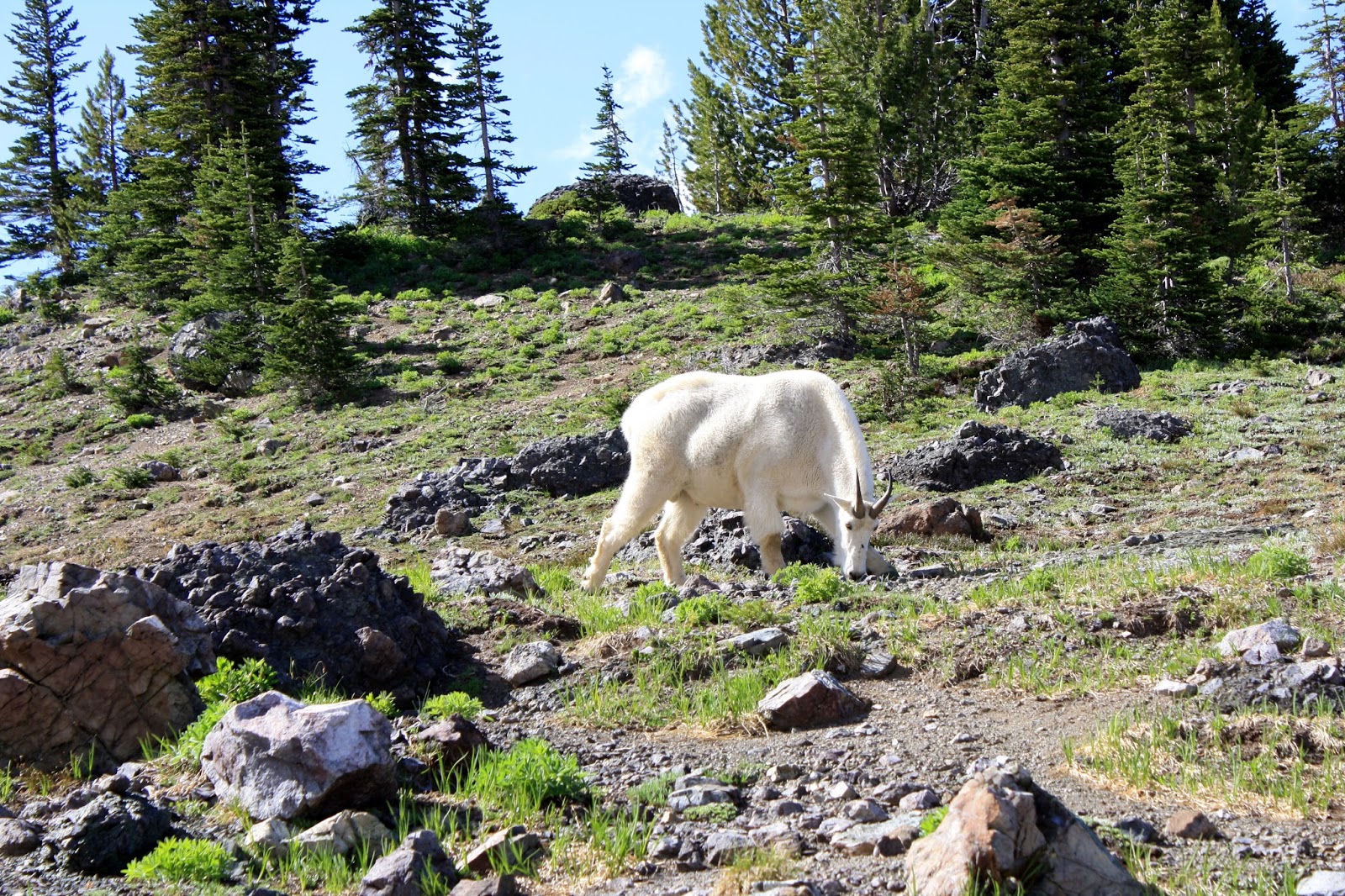
 We had lugged our ice axes along on this trip, which led to lots of questions from day hikers lowers down in the valley. We did briefly use them on a snow field heading down to the tarn, but 98% of what we did was snow free. The tarn was actually quite nice and offered us a chance to refill on water. We watched two goats high up on the ridge slowly make their way down. They had no fear of us and walked right up, a little too close for comfort. It was almost like they had been fed in the past. We thought they were interested in our salt, but they could care less about the spots were we "left our salt." Eventually they move onto a snow patch and just reclined.


Derrick on a big rock

The tarn turned out to actually be pretty large

Reflections


Ahh, the joy of the mountains

One of our goat friends

We picked our way back up to our campsite and began to make our dinner. Soon after, our two goat friends came to join us. It started to get a little creepy as we felt like we were being stalked. We'd looked at them and they'd wander a bit behind the trees. We'd go back to what we were doing and then about five minutes later look behind us and they'd be sneaking up again. This continued for a lot of the evening. By sunset, they had moved on. 

Mount Mystery panorama

Sunset panorama

Sunset over Seattle and the Cascades

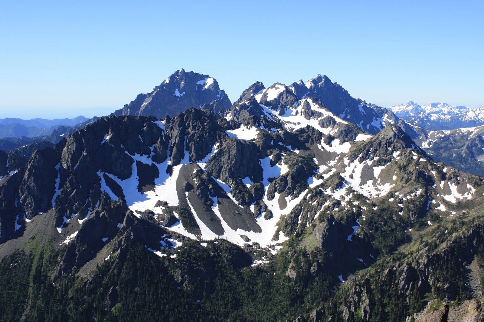
The next morning we were up early to tag Buckhorn before we headed back to the car. Buckhorn was a quick climb up the ridge to a beautiful view. This peak has a high pay off for relatively little work. Gorgeous views of some of the big Olympic peaks; Constance, Deception, Warrior, Mystery etc, as well as views out over the Puget Sound and into the Cascades. Mount St. Helens, Mt. Adams, Rainier, Glacier, and Baker were all visible. We had the summit to ourselves, well us and a very gutsy chipmunk that stole one of our almonds. After about an hour we pulled ourselves away and headed back down. Two hours later we were at our car. Great weekend in the mountains. 


Fog over the Puget Sound

Rainier  and Adams in the fog

St Helens

Derrick on the summit

Constance and Warrior

Buckhorn summit panorama

I could stay here all day

Buckhorn Lake

The other summit of Buckhorn and Iron Mtn

Looking north from Buckhorn

Summit chipmunk!
Our approximate route


Friday, June 28, 2013

Snowking June 22-24, 2013

Myself plus eight others set out on an ambitious adventure to tag Snowking mountain as the final outing of the Bushwacker's scrambling course. We found it to be quite an adventure. Snowking is a peak on the edge of the Glacier Peak Wilderness not too far from Marblemount. It is accessed from the Cascade River Road (starting at 1,200 ft) via a long steep bushwack up Kindy Ridge. The original plan was to head to a small lake near Cyclone Lake to set up camp for two nights.

After a few exciting creek crossings in our fleat of Subarus, we hit the trail head around 11:00. The hike starts up old road which is now quite overgrown. It gains elevation steadily, but not very steeply. After about three miles the trail opens up and a boot path leads steeply up the hillside. We named this area crescent wrench meadows thanks to two wrenches we found sitting on a rock in almost pristine condition. After a quick lunch we headed up the path.

Crescent Wrench Meadow

This next section is quite steep. The trail is fairly visible, although large blow downs obscure it in some sections. It is very direct, but slow going. After a few hours, we reached a section of trail that comes very near a creek to the west around 4,200ft. There is a small waterfall here. At this point the trail was pretty flooded by snow melt and began to partially covered in snow. By 4,400ft the trail was pretty much all covered, but we continued to climb. We briefly encountered the trail again and used it to traverse the side of the 5116 high point. This turned out to be the only high point of the trip we didn't have to cross.

Diane forges up the climbers trail
Soon after we reached a small saddle and took a brief break. From here it was more up as we continued to follow the ridge. Originally we thought we could skirt around the next high point (5791) but we were blocked by sections of unstable snow and large rock boulders. At this point it was also getting late and we began to realize setting up camp near Cyclone was not realistic. Instead we decided to check out the top of 5791 and see if there was a good spot to set up camp. This turned out to be a great decision. This little summit offered a nice protected area for our tents and panoramic views of the surrounding areas. We arrived at about 7:30 that evening and tiredly dug out tent sites, melted, snow, and cooked dinner. The sunset was quite nice and the super moon was out in full glory. After about 6 miles and 4500ft we had no trouble falling fast asleep.

Our first view of Snowking
The summit near our camp
Heading up to our camp
Digging out the vestibule after a long day
Panorama from Camp
El Dorado 
Hidden Lake Peak and Lookout
Sun beginning to set on Snowking

A Beautiful place
Our camp site with a view
Mt. Formidable
Johannesburg


Watching the sunset

Moon rising
Hidden Lake Peak and El Dorado at Sunset


Snowking sunset


Super moon
The next morning it was time for the real adventure--the summit. We had spent the previous evening staring down Snowking which still seemed pretty far away and rather intimidating. Regardless we headed out ready to conquer. Our team for day two was down to six. Several folks had decided to stay back due to injury and illness, but we were still in good spirits.

From camp we had to drop down about 550ft to a saddle, then climb back up an additional 500ft. This proved to be the theme of the day as three additional high point stood between our camp and the summit. The first two weren't bad. They were snowy and involved kicking steps, but weren't too steep. The next one we decided to attempt to contour around. This was not such a great idea. Things started out fine, but we soon found ourselves on a steep slope with icy snow that did not take steps very well. It involved a lot of concentration and caution to make our way across this slope. The snow field ended when we reached a clump of trees that felt kind of like a dead end. Continuing on was too treacherous because of moats from melting snow. Dropping down, was also pretty rough. It left us with one option--clawing our way through a clump of steep vegetation. This wasn't pretty, but it was the safest option and eventually got us back on the ridge a bit below the high point.

Taking a break along the way

Doing a bit of map and compass work

Looking toward Snowking Lake

Snack break
From here, everything was pretty straight forward. Summit one more high spot on the ridge and then kick step our way up to Snowking. Straigh forward, however, does not equal easy. It was slow going and it felt like we were in a race against the clock, trying to beat our 2:30 turn around time. Eventually, after many snowy steps we made it to the rocky summit block.

Lots of snowy climbing

So close, yet so far away

Almost there

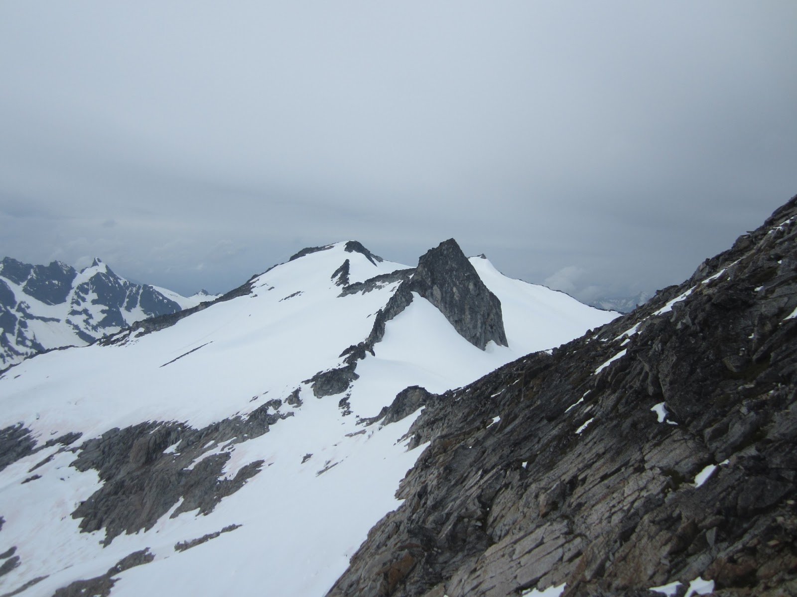
It was another 150ft or so to the summit. Unfortunately it was across a rocky mess that was obscured by weak snow patches. The weather had also been taking a turn this day and rain was quickly approaching. After a few minutes of discussion we decided that it would take us way too long to pick our way up this last section and the best approach was blocked by thin unstable snow. It was bitter sweet to be so close, but not on the actual summit. We stayed positive and declared our rock pile its own little summit. We hunkered down out of the wind, enjoyed a few snacks and the fading view and decided it was time to head down.

Looking west at the storm approaching

Frozen lakes down below

The valley to the southwest

The summit block

Panorama from the "summit"

Mutchler

Out to the north

Doug on our "summit"
It's windy up here
Our camp on the high point on the right and the three additional high points we crossed

Going down was a breeze. It took us about 45 minutes to come down what had taken almost 2.5 hrs to come up. We still had the annoying three additional humps to climb. This time we voted against traversing and just hike up and over all of them. The one we originally contoured proved to be equally tricky to climb over. The snow was steep and there was no direct route. 

Little dots moving down the mountain
We eventually made it back to camp about 8 hrs after we started. By this time, it was raining pretty steadily. We were grateful to see that our team mates who had stayed behind had set up a tarp and melted a new batch of snow. It was an early night for everyone.

We were greeted with smiles and a tarp!

Tired but happy campers

Snowking fades into the mist

Clouds lowering
The next morning, we awoke to rain. We packed up our tents in the rain and hiked down the final 6 miles all in the rain. It was steep and slick and we were pretty happy to see the cars and put on dry clothes. We did run into two mamma blue grouse and their babies on the final stretch of trail which was a fun surprise. Despite the rainy last day it was a great trip in an amazing corner of the world. I think if I were to do this again, I'd go  a bit later in the year in hope of less snow to provide some faster travel, but really this is a beautiful area regardless. 

Patrick earning style points on day three

Our route (gps stopped tracking on our return from the summit) 

Stats:
Total mileage about 18
Elevation gain about 8,000ft
Our team: Doug, Patrick, Celese, Piyush, Martin, Robert, Diane, Winlyn, and me