Friday, June 28, 2013

Snowking June 22-24, 2013

Myself plus eight others set out on an ambitious adventure to tag Snowking mountain as the final outing of the Bushwacker's scrambling course. We found it to be quite an adventure. Snowking is a peak on the edge of the Glacier Peak Wilderness not too far from Marblemount. It is accessed from the Cascade River Road (starting at 1,200 ft) via a long steep bushwack up Kindy Ridge. The original plan was to head to a small lake near Cyclone Lake to set up camp for two nights.

After a few exciting creek crossings in our fleat of Subarus, we hit the trail head around 11:00. The hike starts up old road which is now quite overgrown. It gains elevation steadily, but not very steeply. After about three miles the trail opens up and a boot path leads steeply up the hillside. We named this area crescent wrench meadows thanks to two wrenches we found sitting on a rock in almost pristine condition. After a quick lunch we headed up the path.

Crescent Wrench Meadow

This next section is quite steep. The trail is fairly visible, although large blow downs obscure it in some sections. It is very direct, but slow going. After a few hours, we reached a section of trail that comes very near a creek to the west around 4,200ft. There is a small waterfall here. At this point the trail was pretty flooded by snow melt and began to partially covered in snow. By 4,400ft the trail was pretty much all covered, but we continued to climb. We briefly encountered the trail again and used it to traverse the side of the 5116 high point. This turned out to be the only high point of the trip we didn't have to cross.

Diane forges up the climbers trail
Soon after we reached a small saddle and took a brief break. From here it was more up as we continued to follow the ridge. Originally we thought we could skirt around the next high point (5791) but we were blocked by sections of unstable snow and large rock boulders. At this point it was also getting late and we began to realize setting up camp near Cyclone was not realistic. Instead we decided to check out the top of 5791 and see if there was a good spot to set up camp. This turned out to be a great decision. This little summit offered a nice protected area for our tents and panoramic views of the surrounding areas. We arrived at about 7:30 that evening and tiredly dug out tent sites, melted, snow, and cooked dinner. The sunset was quite nice and the super moon was out in full glory. After about 6 miles and 4500ft we had no trouble falling fast asleep.

Our first view of Snowking
The summit near our camp
Heading up to our camp
Digging out the vestibule after a long day
Panorama from Camp
El Dorado 
Hidden Lake Peak and Lookout
Sun beginning to set on Snowking

A Beautiful place
Our camp site with a view
Mt. Formidable
Johannesburg


Watching the sunset

Moon rising
Hidden Lake Peak and El Dorado at Sunset


Snowking sunset


Super moon
The next morning it was time for the real adventure--the summit. We had spent the previous evening staring down Snowking which still seemed pretty far away and rather intimidating. Regardless we headed out ready to conquer. Our team for day two was down to six. Several folks had decided to stay back due to injury and illness, but we were still in good spirits.

From camp we had to drop down about 550ft to a saddle, then climb back up an additional 500ft. This proved to be the theme of the day as three additional high point stood between our camp and the summit. The first two weren't bad. They were snowy and involved kicking steps, but weren't too steep. The next one we decided to attempt to contour around. This was not such a great idea. Things started out fine, but we soon found ourselves on a steep slope with icy snow that did not take steps very well. It involved a lot of concentration and caution to make our way across this slope. The snow field ended when we reached a clump of trees that felt kind of like a dead end. Continuing on was too treacherous because of moats from melting snow. Dropping down, was also pretty rough. It left us with one option--clawing our way through a clump of steep vegetation. This wasn't pretty, but it was the safest option and eventually got us back on the ridge a bit below the high point.

Taking a break along the way

Doing a bit of map and compass work

Looking toward Snowking Lake

Snack break
From here, everything was pretty straight forward. Summit one more high spot on the ridge and then kick step our way up to Snowking. Straigh forward, however, does not equal easy. It was slow going and it felt like we were in a race against the clock, trying to beat our 2:30 turn around time. Eventually, after many snowy steps we made it to the rocky summit block.

Lots of snowy climbing

So close, yet so far away

Almost there

It was another 150ft or so to the summit. Unfortunately it was across a rocky mess that was obscured by weak snow patches. The weather had also been taking a turn this day and rain was quickly approaching. After a few minutes of discussion we decided that it would take us way too long to pick our way up this last section and the best approach was blocked by thin unstable snow. It was bitter sweet to be so close, but not on the actual summit. We stayed positive and declared our rock pile its own little summit. We hunkered down out of the wind, enjoyed a few snacks and the fading view and decided it was time to head down.

Looking west at the storm approaching

Frozen lakes down below

The valley to the southwest

The summit block

Panorama from the "summit"

Mutchler

Out to the north

Doug on our "summit"
It's windy up here
Our camp on the high point on the right and the three additional high points we crossed

Going down was a breeze. It took us about 45 minutes to come down what had taken almost 2.5 hrs to come up. We still had the annoying three additional humps to climb. This time we voted against traversing and just hike up and over all of them. The one we originally contoured proved to be equally tricky to climb over. The snow was steep and there was no direct route. 

Little dots moving down the mountain
We eventually made it back to camp about 8 hrs after we started. By this time, it was raining pretty steadily. We were grateful to see that our team mates who had stayed behind had set up a tarp and melted a new batch of snow. It was an early night for everyone.

We were greeted with smiles and a tarp!

Tired but happy campers

Snowking fades into the mist

Clouds lowering
The next morning, we awoke to rain. We packed up our tents in the rain and hiked down the final 6 miles all in the rain. It was steep and slick and we were pretty happy to see the cars and put on dry clothes. We did run into two mamma blue grouse and their babies on the final stretch of trail which was a fun surprise. Despite the rainy last day it was a great trip in an amazing corner of the world. I think if I were to do this again, I'd go  a bit later in the year in hope of less snow to provide some faster travel, but really this is a beautiful area regardless. 

Patrick earning style points on day three

Our route (gps stopped tracking on our return from the summit) 

Stats:
Total mileage about 18
Elevation gain about 8,000ft
Our team: Doug, Patrick, Celese, Piyush, Martin, Robert, Diane, Winlyn, and me


Sunday, June 16, 2013

Lichtenberg and Union June 15-16, 2013

This was the first real backpacking trip of the summer. Sam, Sarah, Derrick, and I decided to embrace the snow and go in search of some peaks. We set our sights on Lichtenberg, Union, and Jove off of the Smith Brook Road on the east side of Stevens Pass. We headed out Saturday morning and began our hike a little after 10:00 am. The road still had some snow patches so we had to park the car just before the first set of switch backs. We walked the road to just a little bit before the big hairpin turn to the point where the creek was very near the road and we were in line with the ridge up to Lichtenwasser Lake. From here we took a barring and headed up the ridge line almost due south. On our way up we crossed a fishermans trail and followed that up towards the lake. There was even a handline set out along one steep section. Overall the going to the lake was pretty easy and we were there in a little over an hour. Snow did not become consistent until around 4,600 ft. 

This is where we crossed the creek

Taking a break from 'shwhakin up the mountain

Lichtenwasser Lake

The lake was mostly frozen with some melting around the edge. There were still several feet of snow pack, but the tree wells were starting to melt. We set up camp and dug out a table for lunch. It was a beautiful warm sunny day. After lunch and a little relaxing we began our walk up the northeastern ridge of Lichtenberg. The snow was nicely compacted and the walk was really nice. It was very strait forward, not too steep and had increasingly nice views. We pulled out our ice axes but there were really only a few short section where we needed them.

Our campsite table
Glacier and Union Peak as seen from the ridge

Making our way up the northeastern ridge
Before too long (under and hour) we reached the base of the summit block. Directly in line with the ridge, the peak juts up as a cliff so continuing on our current trajectory was not an option. We were worried about skirting to our left because of the large cornices we had seen along the bowl. Instead we decided to poke around to the right and see how that looked. It started as a nice climb up the snowfield, however, we started to become unsure how and where we would be able to transition from the snow to the rocky summit. Sam continued up ahead and found a spot where we could safely step off the snow although it was slightly precarious. There were about 20 feet really steep snow that started to push my comfort zone and make me really thankful for my ax. 

This is where we came up
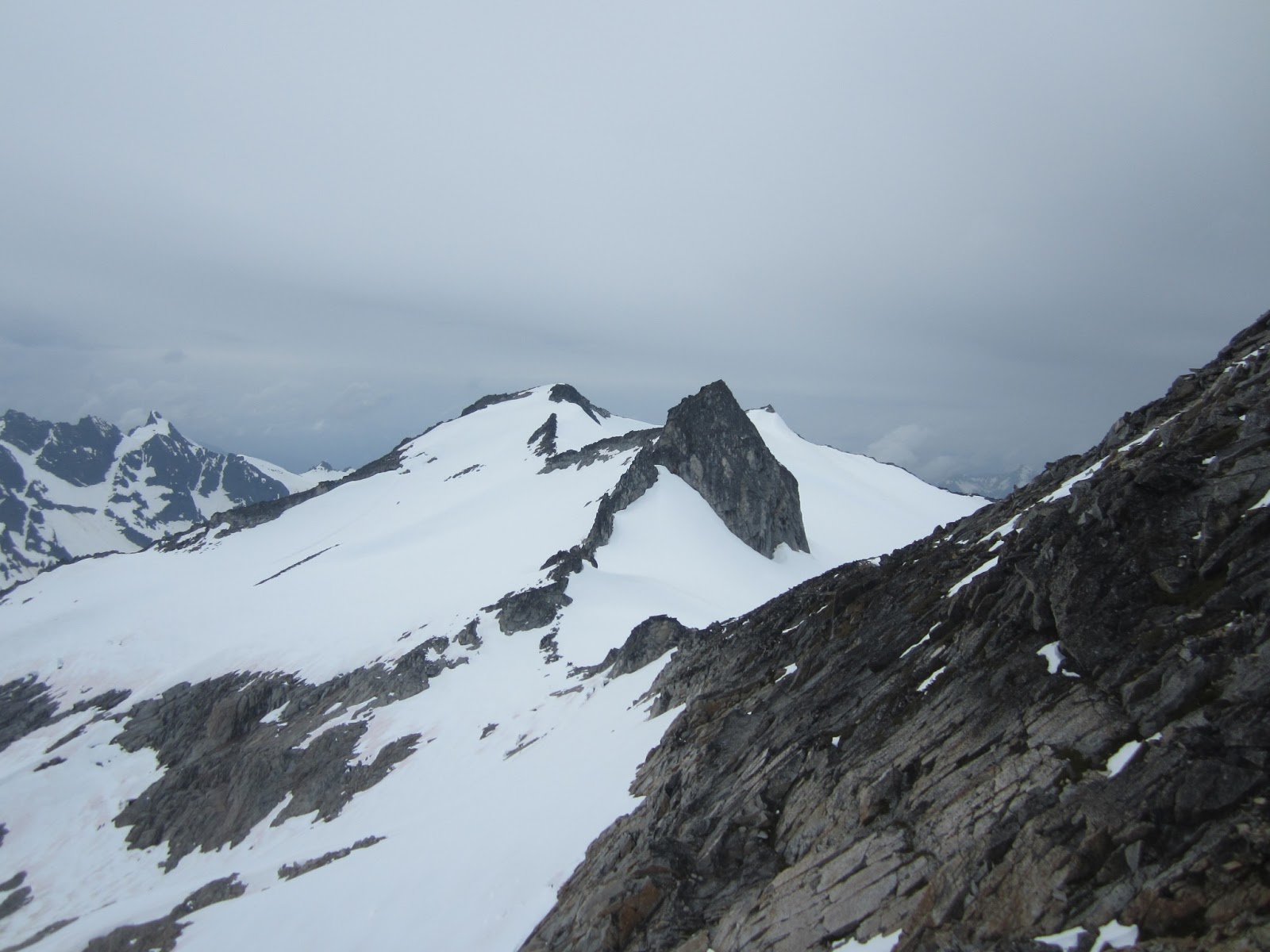
Once we were all on a little bit of solid ground it was time for the final push to the summit. This last section was about 20 feet of rock climbing/scrambling. There were good holds the entire way, but falling here would not have been pretty. Once on top we all let out a little sigh of relief and took in the amazing view. 

Up on solid ground
The panoramic view from Jove to Hinman
From our new vantage point we could see that there was one break in the cornices on the southeastern saddle that would have been possible to climb through. In hind sight, I would have preferred to traverse the bowl and then come up the southeastern ridge (which is an easy walk to the summit), but our route got us where we wanted to go. 

Large cornices above the bowl
Steward poking out
Glacier Peak
McClausland in the front the Monte Cristos and Sloan in the back 
We made it!
So did Sam...
...and Sarah!

Steep slopes on the northern side
A nice hangout spot a bit north along the ridge
Looking toward Lake Valhalla
After about an hour on the summit we headed back down to the lake. We were able to glissade two short runs in the bowl, but there were enough trees that we had to plunge step a lot of the way. We hit one pretty slick spot that gave Derrick, Sam, and I some practice with our self arrest skills, but overall the descent wasn't too bad. 

We glissaded near the bottom of this photo
The next morning we headed back down towards the road. We walked about 1/4 of a mile past the hair pin turn and headed up the much overgrown trail that leads towards Union Gap. We later learned that there is a newer trail that goes directly from the turn in the road, but our USGS map didn't show this.We took the trail until it flattened out and headed up the ridge line toward Union. The going was slow. We stayed right along the spine of the ridge which is rocky in places. We didn't hit snow until over 5,000 ft and even then it was patchy and not very ideal. I think this walk up would have been more pleasant a few weeks ago with a little more snow coverage. We found this bushwhack much slower than the one up to the lake.

Lichtenberg from the road
We made our way up to the unexciting peak of Union and decided that we would call it a day. We were pretty tired after our previous day and were worried the extra ridge walk to Jove was going to put us home pretty late that night. Going back down was much easier than we were expecting which was a pleasant surprise. We felt pretty good about our decision to turn around because it began to rain pretty hard once we hit the road. Coming down Union would have been much harder in the rain. We made it back to the car at around 3:30 and were feeling pretty accomplished from our weekend of scrambling.  

Our approximate route

Sunday, June 9, 2013

Denny Mountain (no summit) - June 9, 2013


As part of the Bushwhacker's scrambling class, we headed up to Snoqualmie Pass to practice our snow and ice ax skills. It was a fun day with surprisingly nice weather. We started at the Alpental parking lot and began heading up beneath the lifts. We practiced walking with our ax, moving in balance, and turning. Near the junction of Lower International and Cascade Traverse, we set up a bench and began practicing self arrests. Basically you get to lower yourself down a slope in a bunch of different positions and practice stopping with your ax. It was a little unnerving practicing going down head first on your back as you must trust someone to hold your feet while you dangle upside down into that position. We learned a lot of important skills and played in the snow like a bunch of kids. 


Doug one of our instructors

Getting ready to launch myself (and hopefully stop)

Once we had mastered our self arrest, it was time to put it all together and do some climbing. We headed up the International ski run taking turns leading and kicking steps. It's tiring work, but also surprisingly meditative. You can really get in a rhythm and all your mind is really thinking about is taking the next step. Eventually we made it to the top where the last ski lift ends. At this point you're almost to the top of Denny Mountain, but not quite. We took in the view and hung out on the stationary lift chairs.


Up we go!

Our last skill of the day was glissading which basically means sliding on your butt down the mountain using your ax to control your speed and direction. This was by far the best part! We descended via the Edelweiss Bowl, which was my first ever descent down a black diamond ski run (although it was entirely on my rear!). From there we picked our way back down to the cars, plenty tired and ready for dinner and beer in North Bend. 

Saturday, May 11, 2013

White River Camping and Mt Sauer - May 11-12, 2013

Derrick and I ended up with an unplanned 3-day weekend and decided to head out for some car camping. Although things are starting to melt out it was a little challenging to find too many longer hikes that were snow free. The weather was also a little bit rainy so we decided to head east of the mountains.

Our original thought was to camp at Fish Lake right near Lake Wenatchee. However, we were unable to find any camp sites near the water that weren't already taken. Our next thought was along Lake Wenatchee, but a big storm in December has left many roads closed due to blow downs. We perused a few other forest service roads that pushed the off-road limits of the civic. Then we checked out our map and decided to head up the road along the White River.

I'd never been back in this area before and it was much more scenic than I had imagined. We drove for a ways and decided to see how far back we could get on some of the forest service roads. We almost made it to the very end of the road before hitting a patch of snow that blocked access. We then headed back to the turn out for Auto Tour Stop #4 and found a nice campsite along the roaring river. We thought we were going to have it all to ourselves until a family with a camper pulled in. Luckily they were pretty far away and the river drowned out any noise. It looked like we might have been the first people to camp there for the season as the site was littered with fire wood.

Our campsite by the river

We had a relaxing evening, grilled some burgers, and sat by the fire til turning in for the night. The next morning we debated for a while on our plan of action. We decided to check out the other three auto tour stops along the drive. One led us up a long winding road to what we assumed would have been a look out, but we were stopped after several miles by a large blow down. Then we considered the grooling hike up to dirty face lookout, but weren't sure about the snow. We settled on Sauer Mountain in Peshastin, not too far from Leavenworth.
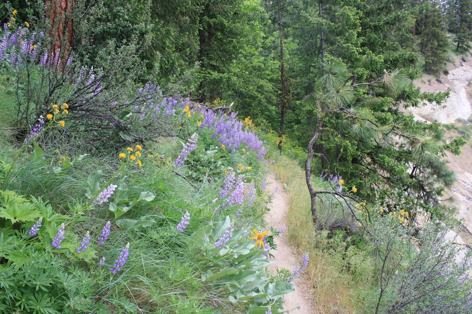
Flowers along Sauer trail

Sauer was a nice hike and actually a bit steeper than I imagined. It was a nice climb through lots of meadows of flowers. Arrow leaf balsam root, indian paint brush, and lupine were all putting on a nice show. At the top we had good view of the Enchantments and the south end of the Glacier Peak wilderness. After the hike we made a quick stop in Leavenworth then headed back to Seattle.


Lupine


Arrow Leaf Balsam Root and Lupine

Our lunch break a little bit below the summit

Panorama from the top

Clouds moving in over the Enchantments

More flowers

Penstemon

Derrick at the top

Me and Leavenworth down below

Heading back down