This past weekend I had a work event on Saturday morning in
Grayland and again on Monday night in Port Angeles, and guess what lies between
these two towns...the Olympic Mountains! Not wanting to lose an entire
beautiful July weekend to work, I dragged along Derrick to my work events and
we managed to squeeze in two nights of backpacking. Destination-- Marmot Pass
and beyond.
Marmot Pass is on the eastside of the Olympics in the Buckhorn
Wilderness about 5 miles up the Big Quilicene River Valley and receives lots of
praise in guide books and trip reports and for us, this trip did not
disappoint. Because I had to work for the first half of the day and because
Grayland isn't exactly close to this hike, we didn't make it to the trail head
until almost 7:00pm. We decided to just hike in as far as we could and set up
camp for the night. We were hoping to at least get to Shelter Rock campground
or beyond, but after about an hour of hiking we were informed that a large
group of kids had taken over that spot so we decided to just call it an early
night at a little spot near the creek just before Shelter Rock.
 |
| Camp the first night |
At some time in the wee hours of the night I woke up to Derrick informing
me that there was an animal outside our tent and it was digging. I thought he
was crazy and should go back to sleep, but sure enough there was a pretty good
size pile of dirt on the rain fly. He thought it was a badger, but I had a hard
time believing it. After a few minutes the culprit revealed himself—a tiny
little mouse. Again, I tried to go back to sleep, but Derrick was not happy
with the little rodent. His solution; turning his headlamp on and shining it where the mouse had been digging, all night long! Well, it did work.
The next morning, we were up and on the trail by about 8:00 and up at the pass around 10:00am. Since it was a Sunday, we saw
lots of folks coming down from the pass and went in search of a place to set up
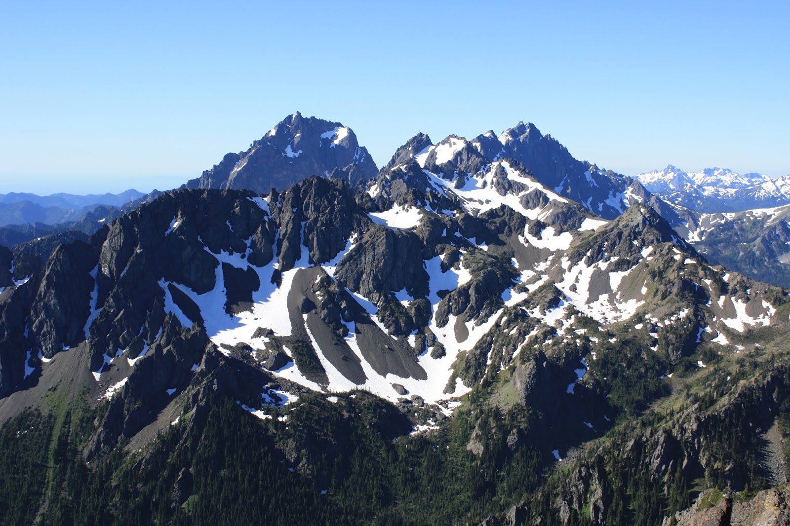
for the night. From the pass we continued up the south ridge over to the second
high point where we found a nice spot to camp. The views were great and there
was a patch of melting snow that had enough of a trickle to pump water from.
After a little lounging we decided to head down the southern ridge towards
Charlia Lake and explore.
 |
| The view looking south from our campsite |
 |
| Looking down the Big Quilicene |
 |
| One of the high points along the ridge |
 |
| Looking to the west |
 |
| Looking down at Boulder Shelter |
 |
| If you look real closely you'll see our tent (and Grey Wolf Mtn) |
 |
| The summits of Buckhorn |
 |
| Derrick going up |
 |
| A scenic little tarn along the way |
 |
| Ahh, the joy of the mountains |
 |
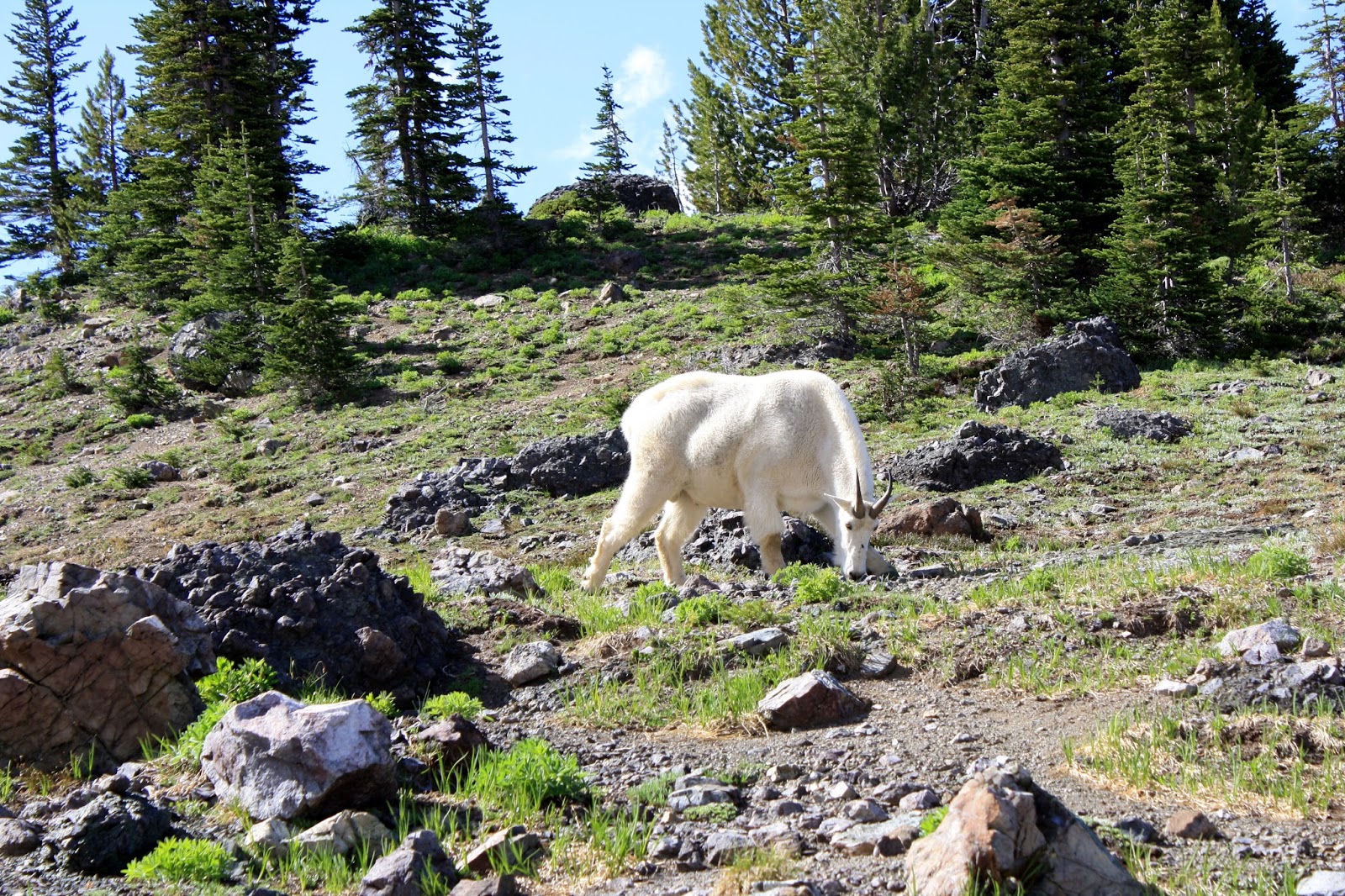
| One of our goat friends |
We picked our way back up to our campsite and began to make our
dinner. Soon after, our two goat friends came to join us. It started to get a
little creepy as we felt like we were being stalked. We'd looked at them and
they'd wander a bit behind the trees. We'd go back to what we were doing and
then about five minutes later look behind us and they'd be sneaking up again.
This continued for a lot of the evening. By sunset, they had moved on.
 |
| Mount Mystery panorama |
 |
| Sunset panorama |
 |
| Sunset over Seattle and the Cascades |


1 comment:
What an ambitious two days. Thanks for posting this adventure. The pictures were beautiful.
Post a Comment